ACADEMIC PROGRAM
Post Graduate Student, Faculty and staff of universities, researchers, senior staff of government and international agencies, and NGOs/INGOs are the appropriate candidates for this program. They can have better career opportunities after the completion of this degree. Students must possess a master’s degree with 3.25/4 CGPA for the enrolment. Total credit requirement for the doctoral program is 84 credits which includes 12 credits of coursework and doctoral dissertation 72 credits.
The target groups of Master’s Degree Program are those who are looking for a career in disaster preparedness, mitigation and management, along with the faculty and staff of universities and research institutions. After completing the Master’s Program, students have the advantage of doing further studies in doctoral program in DPMM.
The minimum entry requirement for this degree is a Bachelor’s Degree from a recognized university. Total credit requirement of this program is 48 credits which include 26 credits of coursework and 22 credits of thesis research. It is 22 months’ academic program distributed in 4 semesters.
The target groups of Master’s Degree Program are those who are looking for a career in disaster preparedness, mitigation and management, along with the faculty and staff of universities and research institutions. After completing the Master’s Program, students have the advantage of doing further studies in doctoral program in DPMM.
The minimum entry requirement for this degree is a Bachelor’s Degree from a recognized university. Total credit requirement of this program is 30 credits which include 24 credits of coursework and 6 credit of special Study or internship . It is 12 months’ academic program distributed in 2 semesters.
The “Flexible Master’s Option” is a new alternative to our traditional “On-campus Master Option” to conduct Master studies at AIT. Students will receive the same degree and the same academic requirements apply as the program offered in our regular “On-campus Option”. Students are allowed to do almost all coursework online via AIT’s Hybrid Mode of Instruction (Certain programs may require a lab on campus). Alternative to the online option, If the student wishes, he/she can also attend the physical
https://set.ait.ac.th/ait-flexible-master-option/ classes at AIT campus.
The “Flexible PhD Option” is a new alternative to our traditional “On-campus PhD Option” to conduct PhD studies at AIT. It is applicable to selected programs at 3 Schools. Students will receive the same degree and the same academic requirements apply as the program offered in our regular “On-campus Option”. Students can do almost all coursework online via AIT’s Hybrid Mode of Instruction (Certain programs may require a lab and research work on campus).
Flexible PhD Option
classes at AIT campus.
FOR PROSPECTIVE STUDENTS
FOR ADMISSION DEADLINE and NOTIFICATIOS : https://ait.ac.th/admissions/
COST OF STUDY: https://ait.ac.th/tuition-and-fees/
A number of scholarships and fellowships are available for this program. The Korean Endowment Fund Scholarships, STARR Foundation Scholarships , Norwegian Ministry of Foreign Affairs Scholarships, and the Netherlands Ministry for Development Cooperation Scholarships are available to qualified applicants. Those who wish to apply for these scholarships must comply with, and complete the requirements as well as submit their applications before October 15 for the January semester and March 15 for the August semester for maximum consideration of credentials.
Scholarships from the Royal Thai Government (RTG) are also available for Thai applicants to the program. Click here for more information on available scholarships and assistantships in AIT.
Please note that admission to AIT requires proof of English language proficiency such as certificate of English as medium of instruction or test scores of TOEFL, TOEIC, CU-TEP, etc. (Please view Admission requirements and procedures for more information). Proof of English may be submitted within a month after the application deadline.
For More Details Visit : https://ait.ac.th/financial-aid/ and https://ait.ac.th/financial/ait-scholarships/
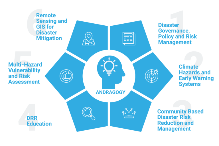
KEY RESEARCH AREA
COURSE OUTLINE
Course Objective:
Disaster risk management and governance particularly for natural hazards is an emerging concept in the disaster research that is closely related to risk and environmental governance. Disaster risk governance influenced by overarching societal governance systems. Mainstreaming of Disaster Risk Reduction (DRR)
is a governance process enabling the systematic integration of DRR concerns into all relevant development spheres. Well-coordinated and efficient disaster governance approaches contribute to long term sustainability. The course will also structure in line with the SFRRR 2015 -2030 priorities. The objective of this course is to provide students with a sound knowledge on major and emerging issues and viewpoints confronting recent trend on disaster governance, policy and risk management.
Learning Outcomes:
Upon successful completion of this course, the students will be able to:
Explain the concepts of disaster risk management and governance
Explain Policy issues at the National and subnational level pertaining to disaster risk management
Explain the critical issues and challenges on the risk governance and policy related to the natural
Analyze rural and urban development concerns and its linkages with disaster risk
Do critical analysis for DRR mainstreaming challenges in regional and local context
Prerequisite: None
Course Outline:
I. Concepts on Background
1. Disaster risk management phases
2. Concepts of disaster risk management and governance
3. Risk Governance theories and framework for natural hazards
4. Risk Governance Challenges
5. Institutional framework on disaster risk governance
6. Understanding risk determinants
II. Development and Disaster Risk Reduction
1. Urban and Rural Development concepts
2. Disaster resilience and critical infrastructures
3. Governance of cascading impacts of natural hazards
4. DRR Mainstreaming framework
5. Nature Based DRR initiatives
III. Disaster Governance and Policy, Planning
1. National and sub-national DRR initiatives
2. Risk governance and Resilience
3. Adaptative risk governance
4. International and Regional Policy on DRR
Course Objective:
The objective of this course is to develop the student skills and knowledge on the disaster risk reduction process for the communities at the local level. The course will also provide knowledge to understand the importance of community participation in the disaster risk reduction and management process. The course covers aspects as diverse as stakeholder analysis, vulnerability and resource assessment, participatory approaches in Community-Based Disaster Risk Reduction (CBDRR), risk reduction implementation, advocacy and challenges faced.
Learning Outcomes:
Upon successful completion of this course, the students will be able to:
Apply the principles and concepts of community based approaches of disaster risk management
Identify the major issues and concerns of the community-at-risk
Apply tools and techniques of Disaster Risk Assessment
Evaluate the strategies and frameworks for community based disaster risk reduction
Prerequisite: None
Course Outline:
I. Theory, Concepts and Approaches
1. Fundamental Features, Elements and Processes
2. Concepts and Approaches
3. Regional and International perspectives
4. Concepts of Social capital
II. Participatory Approaches to Disaster Risk Assessment and DRR Planning
1. Community Training
2. Tools and Techniques for Participatory Approaches
3. Community Risk Reduction Plan
4. Participatory Monitoring and Evaluation
III. Disaster Risk Assessment at the Community Level
1. Community based Hazard and Natural Disaster Risk Assessment
2. Capacity and Vulnerability Assessment
3. Analysis of Stakeholders and Resources
4. Social Accountability and Commitment of CBDRR Practitioners
IV. Community Resilience and Disaster Risk Reduction
1. Disaster Risk Reduction Measures
2. Community Early Warning System
3. Strengthening Livelihoods through Resilience
4. Disaster Education and Community Awareness
5. Ecosystem Approach for Community resilience
Laboratory Sessions (Field based practicum):
1. Selection of Study Area (District / Tambon)
2. Developing Framework for Hazard, risk and vulnerability assessment
3. Assessing data needs (Primary and Secondary) and identification of stakeholders
4. Preparation of checklists and short questionnaire for field survey
5. Field visit, survey and data acquisition
6. Analysis and report
Course Outline
I. Introduction to Disaster Management
• Scope and Objectives of Disaster Management
• Basic Concepts and Terminologies in Disaster Management
• Importance of Management in Disasters
• The Management System in Disasters
• Overview of a Disaster Manager’s Tasks
II. Concepts and Terms in Disaster Management
• Disaster Types
• Elements of Disaster Management
• Emerging Trends in Disaster Management
• Institutional Framework for Disaster Management
III. Tools and Methods of Disaster Management
• Prevention and Mitigation Tools
• Preparedness Tools
• Tools of Post-Disaster Management
• Additional tools for Disaster Management
Course Objective:
Climate hazards are one of the important triggers to disasters, and are likely to gain further prominence with changing climate. Weather and climate information also constitute key starting points for many Early Warning Systems. Early Warning Systems consist of climate prediction and translation of the severe weather/climate information into potential hazards understood by the users. The course is designed in five modules covering basic understanding of earth’s climate system, introduction to weather and climate forecasting, and the architecture of Early Warning Systems in the context of hydro-meteorological hazards.
The course aims to provide a clear understanding of basic aspects of weather and climate hazards, along with frameworks of meteorological observational and forecasting systems. It will also introduce various operational forecasting products generated that are crucial to disaster preparedness and management.
Learning Outcomes:
Upon the completion of this course, the students will be able to:
Effectively use weather and climate information to assess climate and disaster risks
Apply methods for collection and monitoring of climate data as per international protocols and standards
Design a framework for early warning systems for hydro-meteorological hazards
Apply the knowledge of climate change to reduce disaster risks
Prerequisite: None
Course Outline:
I. Introductory Climatology
1. Earth’s climate system and atmospheric composition
2. General circulation and global climatology
3. Variation of meteorological parameters in different time-scales
4. Concepts of Climate Change and Climate Variability
II. Weather and Climate
1. Meteorological Observations and predictions
2. Global and regional climate models
3. Weather forecasting and Climate services
III. Climate Extremes
1. Extremes in climate variables
2. Role of El Nino and other similar oscillations
3. Thunderstorms, tornadoes and tropical cyclones/typhoons
IV. Climate Change
1. Changing atmosphere and observed trends
2. Future climate change and its impacts
V. Early Warning Systems
1. Early warning system concepts
2. Flood forecasting and warning systems
3. Drought early warning systems
4. Cyclone Early-warning systems
5. Heat health early warning systems
Course Objective:
Floods and droughts are one of the most destructive natural phenomena in Asia and around the world. They can cause serious damage to life, properties, public utilities and infrastructures. They hamper social and economic growth of many countries. The objective of this course is to provide knowledge on hydrology of floods and droughts; understanding of their causes, frequencies and magnitudes; modeling
of floods and droughts; effective management and mitigation measures of floods and droughts.
Learning Outcomes:
On completion of this course, the students will be able to:
Identify and solve problems relating to hydrology of floods and droughts and analyze their characteristics
Apply models of floods and droughts
Design forecasting and warning systems
Assess impacts of floods and droughts
Identify and apply floods and droughts mitigation measures to manage associated risks
Prerequisite: None
Course Outline:
I. Introduction and Overview
1. Hydrologic cycle and processes
2. Hydrologic measurements
3. Extreme events
4. Forecasting and warning
5. Impact and mitigation
II. Hydrology of Floods and Droughts
1. Estimation techniques
2. Flood characteristics and their distributions
3. Drought characteristics and their distributions
4. Modeling of floods and droughts
III. Forecasting and Warning Systems
1. Overview of forecasting models
2. Equipments for forecasting
3. Flood and drought warning
4. Warning procedure and dissemination
IV. Impacts and Assessment of Floods and Droughts
1. Impacts: physical, socio-economic and environmental
2. Assessment tools and techniques
3. Vulnerability and capacity assessment
4. Stakeholder participation
V. Floods and Mitigation
1. Mitigation measures
2. Preparedness, readiness, emergency response and rehabilitation
3. Flood damages
4. Institutional arrangement
5. Collaboration and coordination
VI. Droughts and Mitigation
1. Mitigation and adaptation measures
2. Drought damages
3. Drought management
4. Water management schemes to cope with drought
5. Institutional arrangement
6. Collaboration and coordination
VII. Risk Assessment and Management of Floods and Droughts
1. Hazard, vulnerability and risk
2. Risk assessment methods
3. Risk management
4. Preparedness and mitigation
Course Objective:
An earthquake can create a variety of detrimental effects to people in the affected area. To effectively minimize these effects, a mix of knowledge from many disciplines is required. The objective of this course is to provide this required mix of knowledge, which includes the nature of earthquakes and their consequences, methodologies for assessing earthquake hazard and earthquake-induced losses, and
strategies for earthquake risk mitigation, emergency response, and disaster recovery, etc
Learning Outcomes:
On completion of the course, the students will be able to:
Recognize various possible impacts and losses caused by earthquakes (liquefaction, landslide, tsunami, etc.)
Carry out a preliminary assessment of seismic hazard of a given city or town
Conduct a preliminary estimation of potential losses in an earthquake scenario
Develop effective strategies for earthquake risk mitigation, emergency response, and disaster recovery
Prerequisite: None
Course Outline:
I. Basic Seismology
1. Types of Earthquakes, Causes of Earthquakes
2. Plate Tectonics, Active Faults
3. Seismic Waves, Seismographs
4. Earthquake Magnitude, Ground Shaking Intensity
II. Seismic Hazard Assessment
1. Types of Seismic Hazards
2. Deterministic and Probabilistic Seismic Hazard Assessments
3. Modelling of Seismic Sources
4. Ground Motion Attenuation Relationships
5. Probabilistic Seismic Hazard Analysis
6. Seismic Hazard Maps and their uses for Earthquake Disaster Mitigation
III. Tsunami
1. Causes and Nature of Tsunami
2. Characteristics of Tsunami Waves
3. Damage and Impacts by Tsunami
4. Tsunami Warning System
5. Tsunami Hazard Maps, Tsunami Risk Mitigation Measures
IV. Earthquake-Induced Ground Failures
1. Soil Liquefaction
2. Evaluation of Liquefaction Hazard
3. Mitigation Measures for Liquifaction
4. Earthquake-Induced Landslides
5. Surface Rupture along Fault
V. Seismic Vulnerability of Buildings and Structures
1. Lessons Learned from Past Earthquakes
2. Seismic Vulnerability of Different Building Classes
3. Key Concepts in Seismic Resistant Design of Structures
4. Various Possible Failures in Structures caused by Earthquakes
5. Strengthening and Mitigating Seismic Risk
VI. Seismic Loss Estimation
1. Methodology for Seismic Loss Estimation
2. Vulnerability Assessment for Buildings, Lifelines, and Other Structures
3. Estimation of Physical Damage, Number of Casualties, and Economic Losses
4. Application of Seismic Loss Estimation in Emergency Response & Risk Mitigation
VII. Strategies for Earthquake Protection
1. Getting the General Public Prepared
2. Construction Control & Building Stock Management
3. Earthquake Education
4. Earthquake Insurance
5. Earthquake Emergency Management (Search & Rescue, Medical Emergency, etc.)
6. Earthquake Recovery
7. Physical Reconstruction
8. Roles of National and Local Governments in Earthquake Risk Reduction
9. Roles of Urban and Regional Planners in Earthquake Risk Reduction
Laboratory Session(s): None
Course Objective:
Coastal zones occupy less than 15% of the Earth’s land area, while they host more than 40% of the world’s population. The dynamic nature of the coasts makes it challenging to develop and adopt a standard solution for every region; therefore, understanding the coastal processes is the key to developing a successful management plan. Understanding coastal processes and its risk and resilience pathways are essential as coastal areas are at risk from erosion, rising sea levels, tsunamis, storm surges, etc. Climate change and associated outcomes will further worsen the situation in the near future. Moreover, the coastal areas are associated with critical economic infrastructures like seaports, Oil refineries, power plants, and not to mention tourism infrastructures, as well as fishing establishments which are subjected to coastal hazards that make the economy and the coastal population vulnerable. Modeling and forecasting coastal natural hazards will help developing various mitigation and adaptation strategies. In this module, the students will learn about the coastal processes, major hazards associated with the coastal environment, and their possible site-specific solutions. The module also deals with modeling and forecasting various climate-related natural hazards like erosion, sea level rise, storm surge, and coastal flooding, which are essential for coastal management & policies.
Learning Outcomes :
Upon successful completion of this course, students will be able to
Understand the coastal and estuarine dynamics.
Understand the various coastal hazards and oceanographic parameter like wave, current, and tide and their influence on coastal processes.
Coastal hydrodynamics and how it is influencing the environmental settings for a particular coastline.
Explain the Resilience Concepts and interrelations with the various coastal processes
Coastal hazards and their impacts on the infrastructure, population and economy
Modelling coastal hazards like erosion, sea level rise, inundation, etc.
Coastal zone management plan and adaptation strategies
Prerequisite: None
Course Outline:
A. Basic concepts of Oceanography, coasts, and estuaries
1. Coasts: Definition and basic concepts of coastal processes.
2. Coastal Geomorphology: Types of coastal landforms and their development.
3. Estuaries: Processes and classifications.
4. Tides, waves and their generating forces; shallow and deep-water waves; near-shore current,
longshore current, reap current, and sediment movement.
5. Coriolis effect, Ekman transport, the concept of upwelling and downwelling, thermohaline
circulation, effects of stratification, T-S diagrams.
6. Shallow and deep-water wave theory; Kelvin and Rossby waves.
7. Currents. types, generation, and significance, world currents
B. Coastal hazards and modelling
1. Types of coastal hazards and their impacts.
2. Erosion: coastal erosion process and shoreline shifting from satellite data.
3. Sea level rise: global and regional sea level rise, causes and impacts, sea level rise
projections, and, future coastal inundation.
4. Cyclones and storm surges
5. Storm Surges and effects of storm surges on the coastal environment.
6. Causes of coastal flooding and its effects.
7. Tsunamis, generation propagation, and impact.
B. Resilience Concepts and Coastal Processes
1. Fundamentals concepts of resilience
2. Typology of coastal infrastructure
3. Impacts of coastal hazards on infrastructure, population and economy
4. Impact chain analysis for coastal systems
C. Coastal Zone Management and Adaptation Strategies:
1. Guidelines for Coastal zone management; Impacts of construction on the coastal zone,
construction of jetties, breakwaters, sea walls, revetments, etc.;
2. Application of Integrated Coastal Zone Management plan for the sustainability of coastal
ecosystems and relationship with SDG.
Laboratory Session(s):
1. Basics of remote sensing and GIS application on Coast and ocean.
2. Climate change and observations from various satellite data.
3. Erosion modeling: historical erosion observed from satellite imageries.
4. Sea level rise: PSMSL datasets and trend analysis, future prediction models.
5. SLR-induced inundation modeling
6. Coastal flooding: inundation modeling using Google Earth Engine, inundated areas during
historic catastrophic events.
7. Loss and damage assessments of coastal infrastructures
Course Outline
I. Introduction
• Spatial Information Engineering for Disaster management
• Applications of Remote Sensing and Geographic Information for Disaster Mitigation
II. Principle of Remote Sensing
• Satellite Remote Sensing for Damage Detection
• Optical Sensors
• Synthetic Aperture Radar (SAR)
• High Resolution Satellites
• LIDAR Images
• Image Processing and Analysis
III. Principle of Geographic Information System
• Geo-spatial and Thematic Data Analysis
• GPS and Field Surveying
• Geological Data Analysis
• Social and Economical Data Analysis
• Data Integration and Database Generation
• Data Management and Updating
• Spatial Analysis and Visualization
• Geo-spatial Information Sharing and Services
IV. Advanced Mapping Technology
• UAV (Unmanned Aerial Vehicle)
• MMS (Mobile Mapping System)
• Field Sensor Network
V. Space-Based Technology for Disaster and International Collaborations
• Activity in United Nations
• Activity in Asia
VI. Location Based Service
• Web GIS
• Geo-Portal
• Early Warning System
Course Outline
Module 1: Concepts on Background
• Basic concepts in hazard, vulnerability and disaster risk
• Types and classification of hazards
• Purpose and benefits of hazard, vulnerability and risk assessment
Module 2: Hazards and Vulnerability assessment
• Developing vulnerability indicators
• Tools, data requirements, process for implementation and outputs.
• Assessment Methods and tools
• Hazard, exposure and vulnerability assessment
• Deterministic and probabilistic assessment of hazards
Module 3: Risk assessment
• Understanding Risk Elements
• Risk mapping using qualitative and quantitative methods
• Deterministic and probabilistic risk assessment
• Scenario based disaster risk analysis (scenarios of hazards and mitigation planning)
• Understand how risk assessment is used in risk reduction and disaster preparedness.
• Risk information and decision
Module 1: Introduction and background
• Disaster Typology, Past and Current Events
• Economic perspective: Market and non-market institutions
• Price, supply shock, consumption shock
• Evaluating cost from GDP perspective
• Assignment
Module II: Total Economic Cost perspective
• Sustainable Development Perspective
• SDG perspective
• Individual, Community and Government Perspective
• Benefit-cost principles
• Assignment
Course Outline
I. Human Conflicts and Interventions
• Conflicts: A historical perspective
• Conflicts today: Their nature and characteristics (ethnic, religious, political, etc.)
• Humanitarian interventions: Politics and legality
II. The war on Terror
• The World of Fear: Its nature and consequences
• The political background and geopolitical issues
• The response to the threat
• Preventing terrorism: Challenges and opportunities
III. Complex Political Emergencies
• Definition and nature
• Response to CPEs: The UN, states, NGOs and aid agencies
IV. International Humanitarian System and Assistance
• The growth of Humanitarian evaluation
• Case studies: Somalia, Rwanda, Kosovo, South-east Asia after tsunami, etc.
• Lessons from the case studies
V. Future of Humanitarian Action
• Building capacity: State, NGOs and media
• Preventing emergencies: Local to national efforts